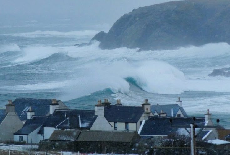
A "weather bomb" is forecast to hit Scotland, bringing strong winds, wild seas and rain by the end of this week.
A 'weather bomb' is an unofficial term for a low pressure system whose central pressure falls 24 millibars in 24 hours in a process known as explosive cyclogenesis says the Met Office.
It occurs in certain circumstances, when the central pressure inside an area of low pressure falls rapidly creating violent winds peaking over a period of a few hours that are strong enough to bring down trees and cause structural damage.
The Met Office say they expect the meteorological phenomenon to occur as the low tracks across the Atlantic Ocean.
Recent relatively benign conditions, albeit with plenty of grey skies, are likely to continue through Tuesday and Wednesday, with some outbreaks of rain in places.
However, a major change in the UK’s weather starts on Thursday, as a front bringing
heavy rain moves eastwards through the day. The highest rainfall accumulations are
likely in western parts of Scotland, England and Wales where 20-30mm could fall in
places, with some snow likely over high ground in the northern half of the country,
especially over the Scottish mountains.
Storm Éowyn, pronounced ‘ay-oh-win’, will begin to influence the UK’s weather early
on Friday, with strengthening winds initially in southwestern parts of the UK with
accompanying heavy rainfall.
This will quickly spread northeast to the rest of the UK during Friday morning. There is also a chance of snow over Northern Ireland, northern England and Scotland as the system initially bumps into cold air, however much of this will quickly change to rain as milder air moves in.
Met Office Deputy Chief Meteorologist Mike Silverstone said: “Storm Éowyn will bring a period of very unsettled, potentially disruptive, weather to the UK through Friday and into Saturday.
“The strongest gusts are likely to be felt across parts of Northern Ireland, northern England, northwestern Wales and western Scotland, where exposed sites could get gusts in excess of 80mph, which has the potential to cause impacts for those in these areas. There will also be some heavy rain, bringing some unpleasant conditions to end the week.
“The initial warning for Storm Éowyn has been issued several days in advance, so it’s important to stay up to date with the forecast as further details emerge in the coming days.”
The change in conditions is being driven by the weather over the other side of the Atlantic.
A large, very cold pool of air over parts of North America is generating a stark contrast in temperatures across the continent, acting to strengthen the jet stream resulting in deeper low pressure systems being able to develop, this jet oriented such that these lows will then be steered across the Atlantic towards the UK.
Chris continued: “As the low develops over the Atlantic and interacts with the jet stream it will rapidly strengthen, a phenomenon called ‘explosive cyclogenesis’, where the central pressure of a low at latitudes in which the UK lies drops 24 millibars or more in 24 hours.
“This is forecast to happen on Thursday while the system is out over the Atlantic and it will be a mature feature by the time it reaches the UK.”
The weather looks set to turn even more unsettled next week.
As Storm Éowyn weakens and clears to the northeast of the UK, Saturday will remain a breezy day everywhere with strong winds persisting in the north. It will be drier for many, with showers replacing persistent heavy rain.
However, later Sunday, another area of low pressure could bring further wet and very windy weather across the UK.
Storm Éowyn named as strong winds and heavy rain forecast
21 January 2025
